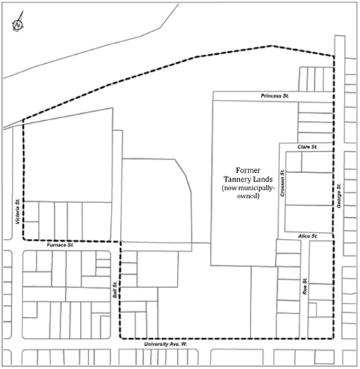
The Tannery District is named for the most recent use of a vacant parcel of land in the heart of the District. The former Tannery lands at 96 Alice Street were acquired by the Town of Cobourg in 2007. The Tannery District includes the Tannery Lands and is bounded by the Canadian National and St. Lawrence and Hudson Railway Corridor to the north, George Street to the East, University Avenue West to the south, and Ball Street, Furnace Street, and Victoria Street to the west. The limits of the Tannery District are identified in the image below.
In 2009, a Community Improvement Plan (CIP) was prepared for the area. A CIP focuses on bringing about physical changes to a targeted area so that, in the medium and long-term, it will be renewed economically, socially, and environmentally. Also in 2009, the Town held a design charrette to explore planning and design features to maximize the environmental sustainability of future development within the Tannery Site.
In late 2016, following approval of a grant from the Federation of Canadian Municipalities (FCM), the Town of Cobourg issued a Request for Proposals (RFP) for the preparation of a Sustainable Neighbourhood Master Plan for the Tannery District. The project kicked off in April 2017.